- Canada West 1854 Maps
- Maps of Muskoka, Victoria, Peterborough, Durham, and Northumberland Counties
- 1830 Map of District
- Nicely illustrates the lakefront and 'back townships'
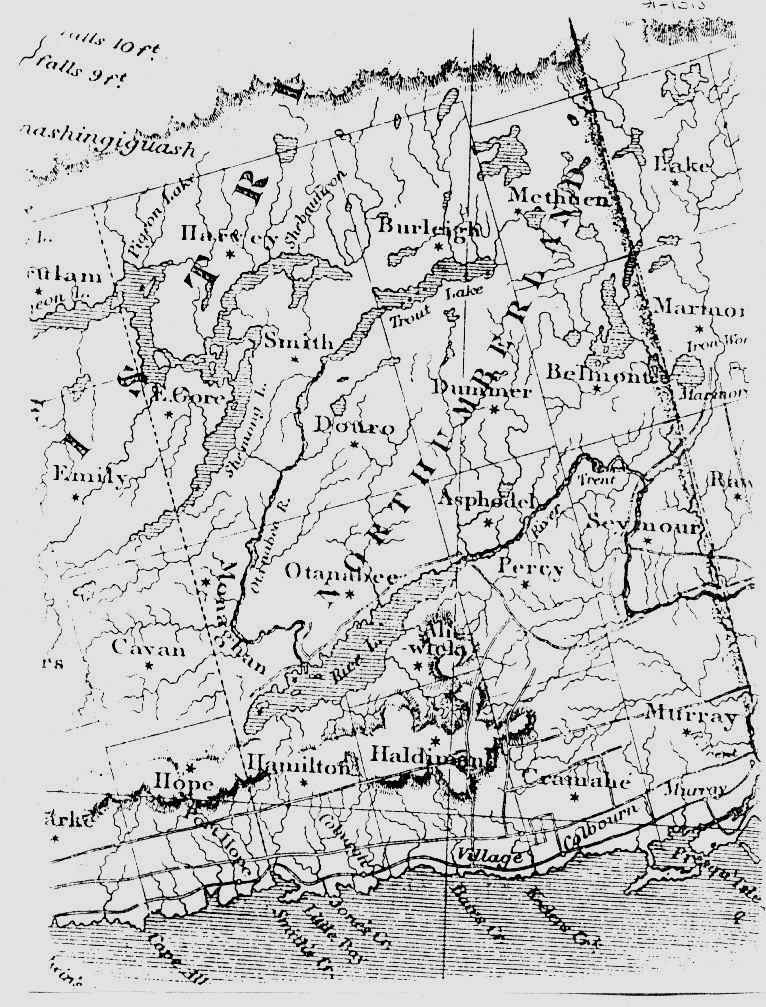
- Newcastle District - 1850
- Another nicely done map of Victoria and region
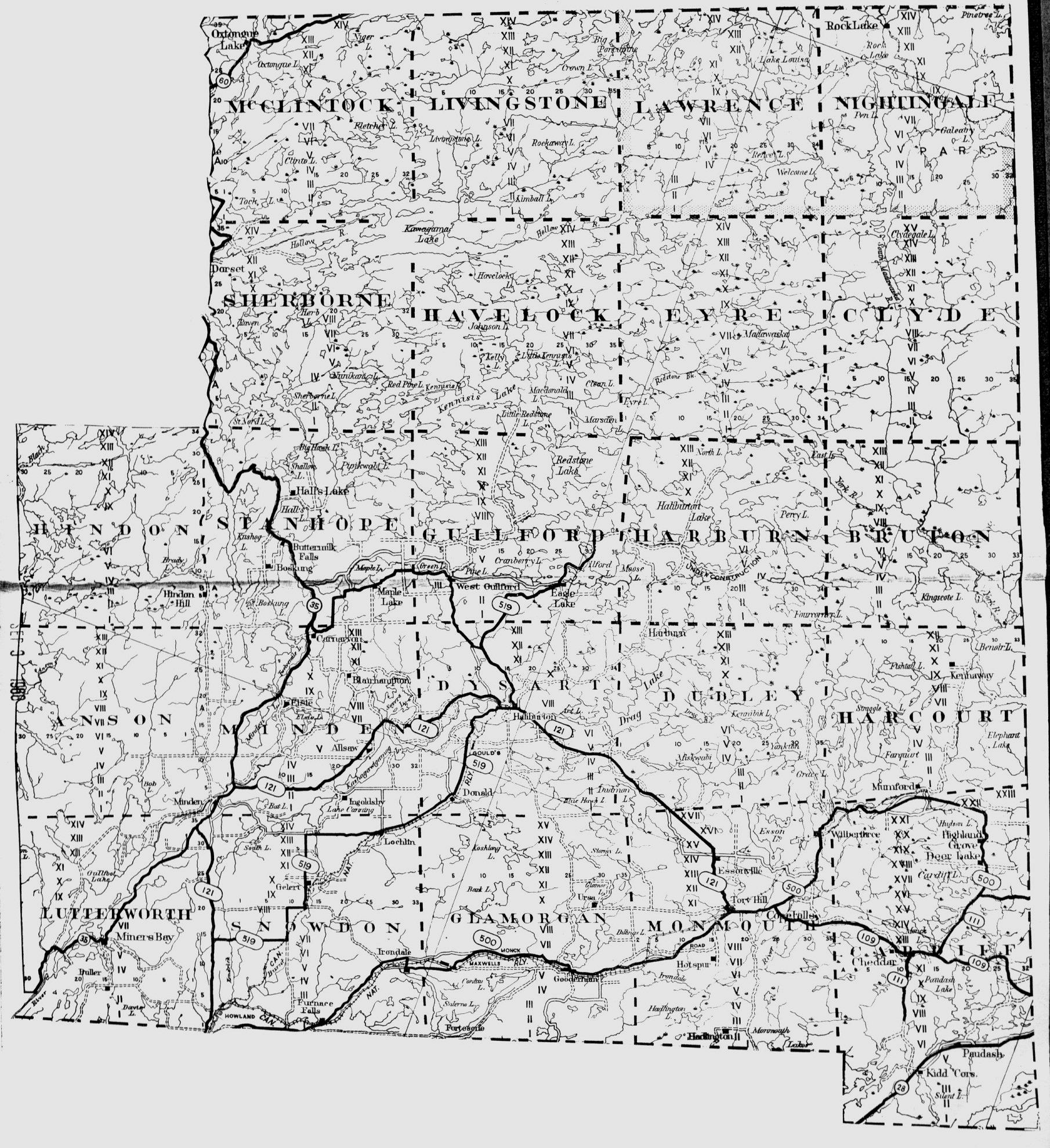
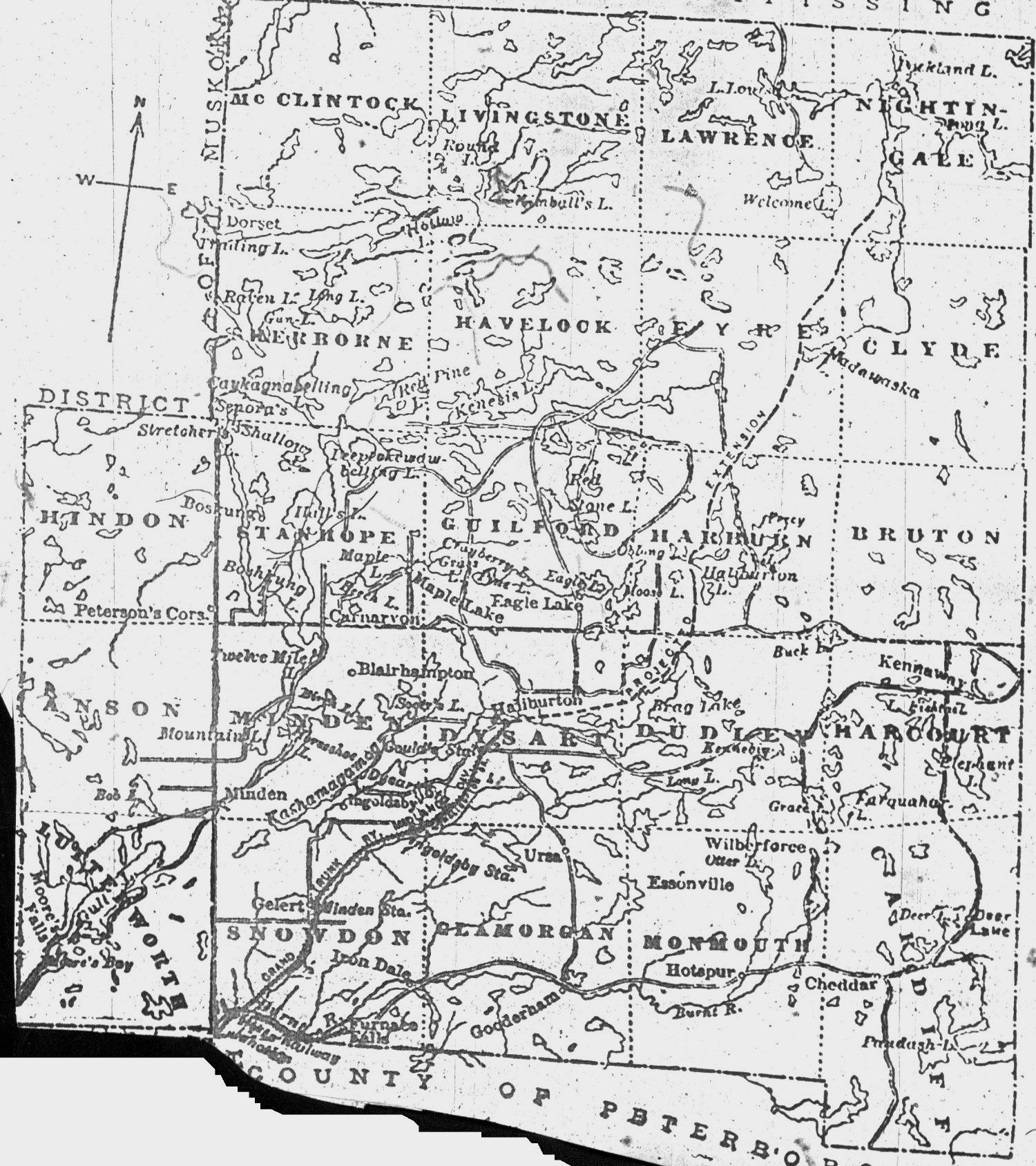
- Haliburton County
- Map shows present-day transportation routes and settlements
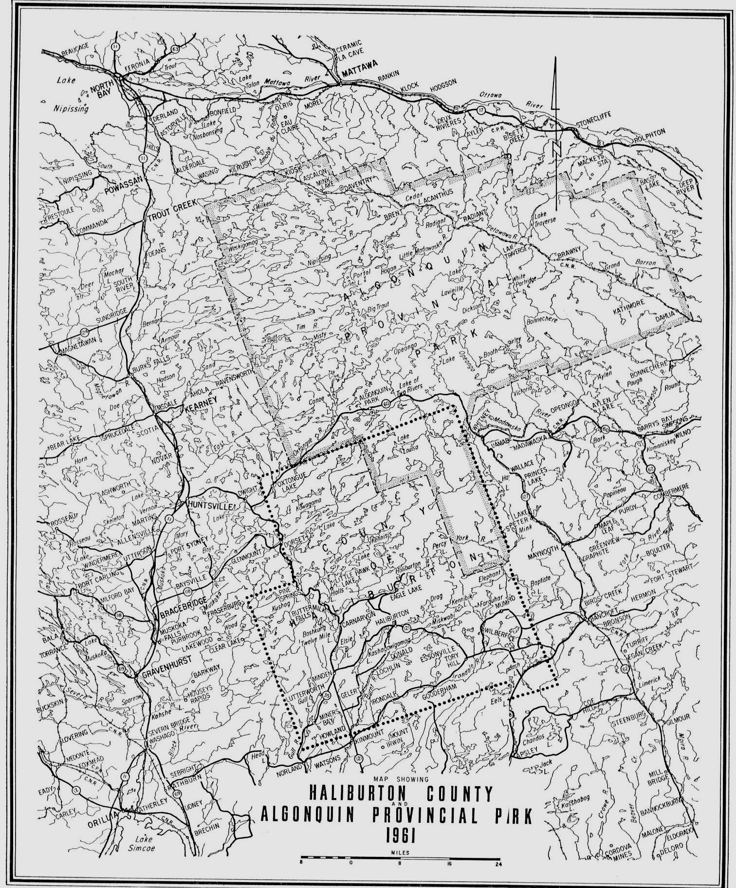
- Haliburton County 1961
- Map illustrates Haliburton and regional setting
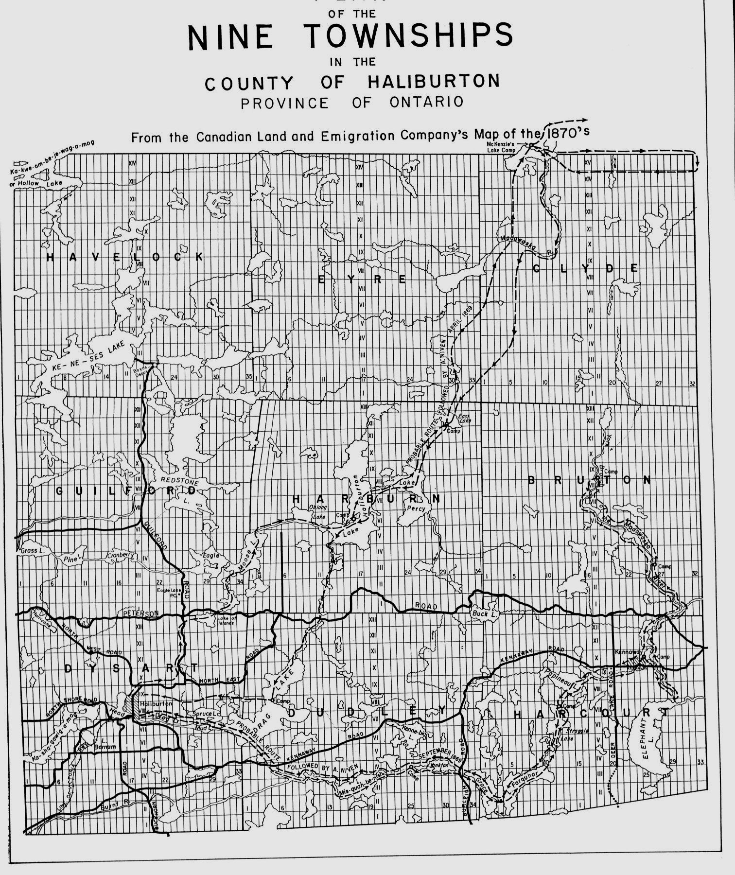
- Haliburton County - 1870
- Map of the 9 Townships controlled by the Canadian Land and Emigration Company
- Haliburton County - 1884
- Map of Western Haliburton Townships (poor condition)
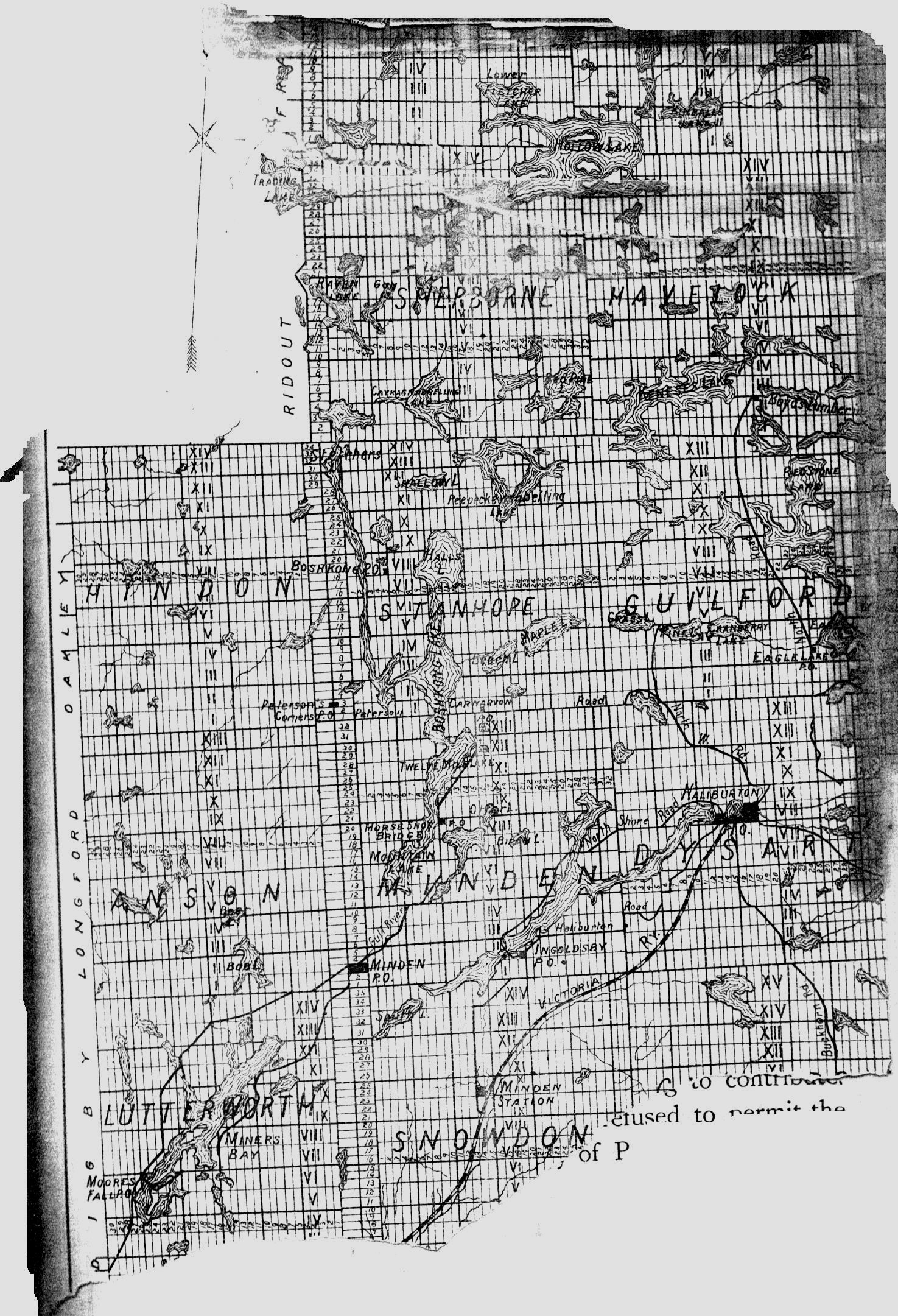
- Haliburton County 1908
- 1908 Haliburton County
|
